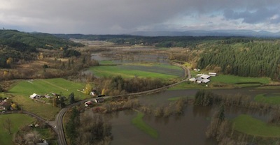
The Lincoln Creek Road area northwest of Centralia sees some sun on Sunday. / Courtesy photo by Sandi Spencer
By Sharyn L. Decker
Lewis County Sirens news reporter
CHEHALIS – A new flood watch has been issued for late tonight through late Wednesday night, with a warm wet weather system headed into the area.
The National Weather Service also says prepare for a windstorm tomorrow.
This storm could bring heavy rain to the Cascade and Olympic mountains for up to 36 hours with a snow level rising to as high as 7000 feet, according to the weather service. Rainfall amounts of five to eight inches with locally higher amounts are expected.
Because of the recent and ongoing flooding, rivers are not likely to have receded to normal levels before this storm hits, forecasters said. Some rivers could rise to higher levels than they have in recent days.
Minor flooding has been occurring along the Chehalis River near Grand Mound since yesterday, according to the NWS.
The threat of landslides will increase as well.
Additionally, a winter storm warning remains in effect for East Lewis County with accumulations of one to two feet of new snow likely by late tonight in the mountain passes, before turning to rain.
A flood watch means conditions are favorable for flooding but
flooding is not imminent or occurring. The NWS advises the public to monitor their latest forecasts and be ready to act quickly if flooding is observed or a warning is issued
•••
Follow the forecasts and watch for weather advisories and warnings:
The link for the National Weather Service Forecast Office in Seattle can be found here and also always on the right hand column of this page, labeled “Weather Alerts, forecasts”
The link for the National Weather Service’s river level observation and forecast for Western Washington can be found here and also always on the right hand column of this page, labeled “River levels”
Tags: By Sharyn L. Decker, news reporter